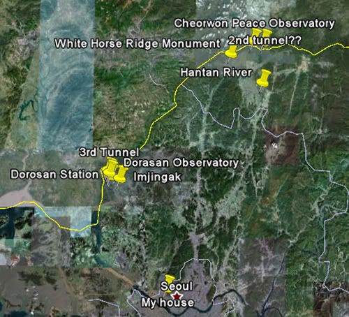
While I haven’t yet been able to visit the northern side of the DMZ, I’ve now been to the southern side twice. In 2004 I visited Panmunjom; the second trip was last Sunday. This time, instead of visiting Panmunjon, I went to two different areas along the DMZ: Imjingak/Dorasan and Cheorwon.
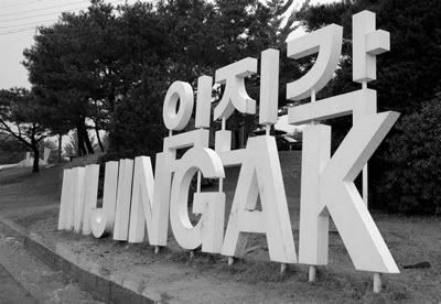
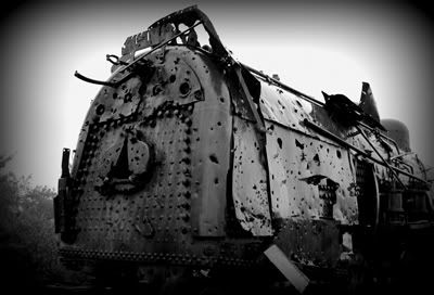
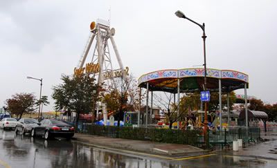
Our first destination was Imjingak, a bizarre and almost resort-like spot located two and a half miles from the southern edge of the DMZ, and roughly three miles from the actual border between North and South. (You can visit Imjingak easily from Seoul without being part of a tour group.) Unfortunately, when we arrived at Imjingak, it was pouring rain. We spent about 30 minutes there, getting completely drenched despite our umbrellas, and (as a result of the nasty weather) seeing very little of what Imjingak had to offer. I caught a glimpse of the Bridge of Freedom – the bridge across the Imjin River that POWs crossed when returning south in 1953 – as well as a war-era train, riddled with bullet holes. I also saw an amusement park and a sodden field full of tents and tour buses as a ginseng festival was held there last weekend. Imjingak is a strange place.
Our soggy group re-boarded the bus and set off for the Third Tunnel of Aggression. As be drove northward towards the tunnel, the clouds lifted, and by the time we arrived outside the tunnel, the day had blossomed into one that was quite beautiful. Next to the entrance to the tunnel is a small museum, where we were shown a video claiming that the DMZ was “a symbol of peace, hope, and nature.” Really? The most heavily fortified border in the world, the result of a war that technically has not yet ended? Really?
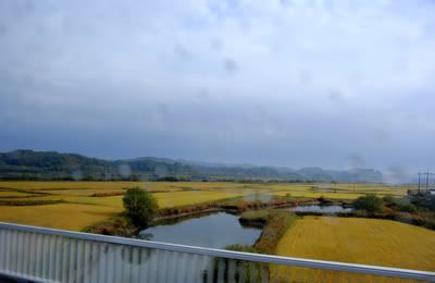
The clouds began to lift on our way to the tunnel...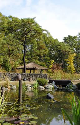
By the time we arrived at the Third Tunnel, the day was gorgeous.
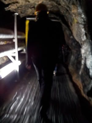
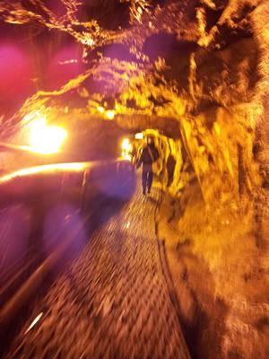
This small park sits atop the tunnel.But on to the tunnel. The Third Tunnel of Aggression was discovered in 1978, and extends about one mile under the border and into the Southern half of the DMZ. It’s a little surreal, as you enter through a gift shop, then you don a hard-hat and descend into the nether regions of the DMZ, and are able to walk nearly all the way to the actual border. (There are a series of barricades at the underground border, so you can’t walk all the way to the actual border itself, although you can see it through a series of small windows in the barricades.) For the most part, the tunnel is barely over five feet, five inches in height, often dropping down to five feet. This proved to be quite a problem for many of the members of the group (who definitely got good use out of their hardhats!), whereas I only had to duck a handful of times. The planned North Korean invasion force must be pretty short.
Photography is forbidden inside the tunnel, although I’m really not too big on rules. While I had to leave my DSLR on the bus, my smartphone fit nicely inside my pocket…
After our underground trip to the border, we re-boarded the bus and set off for the nearby Dorasan Observatory. As a photographer, this was the most disappointing part of the trip. The day was clear, and from the observatory you can easily see both the Kaesong industrial complex and a North Korean city. What fantastic photographs could be made from that point… Unfortunately, you have to stand rather a great distance from the observation deck if you wish to take photos, and there are military guards there to make certain that no one sneaks their DSLR (or even their smartphone) over the yellow line.
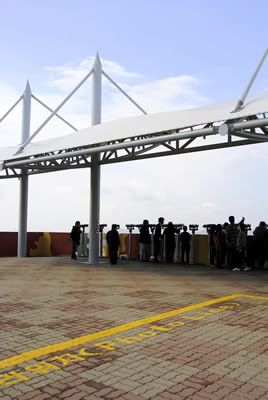
Stupid yellow photo line :-(However, if you have a good zoom lens – and if the hordes of Chinese tourists* will stay out of your way – you can get a shot of two of the north, albeit not the best.
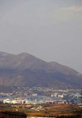
Woohoo, zoom lens. Not the best shot, made from a distance between two tourists at telescopes.*Oddly enough, most of the tourists in the Imjingak/Dorasan area were Chinese, and there were literally hundreds of them. Apparently this is a hugely popular destination for Chinese tourists, which seems rather odd to me, as there wouldn’t be a divided Korea had China not entered the war…
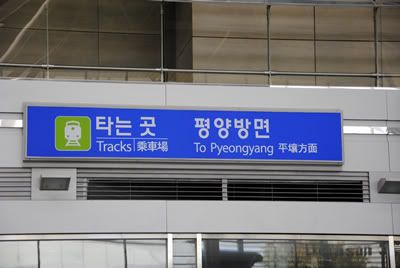
After leaving the Dorasan Observatory, we went to Dorasan Station – a modern Korean train station from which trains can depart headed for Pyeongyang. Notice I said they “can” not that they “do.” The station is also under military guard, although the guards here were very pro-camera, and seemed to quite enjoy posing for pictures themselves.
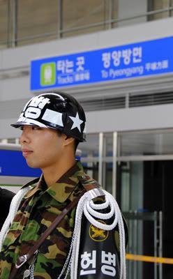
We left Dorasan Station, and drove approximately two hours east, to the Cheorwon area. We stopped for lunch about ten miles south of the border, at a beautiful area near the Hantan River.
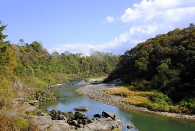
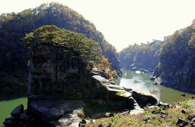
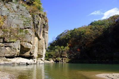
After lunch, our next destination was the Second Tunnel of Aggression, discovered in 1975. This one is located in a much more remote area, and we were the only tourists. Again we donned hardhats and walked under the DMZ, nearly to the border. This tunnel was both wider and taller than the Third Tunnel, although the taller members of our group still had a tough go of it. And again, photography is forbidden inside the tunnel.
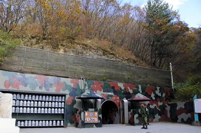
We left the Second Tunnel, and drove to the Cheorwon Peace Observatory. (Again with the ironic names! How can an observation platform designed to view the most heavily fortified border in the world be a “peace observatory”??) In theory, locations for photographs from the Cheorwon Peace Observatory are restricted in a similar manner to the Dorasan Observatory. However, while Dorasan contained numerous military guards who were quite vigilant in their efforts to prevent photos, no one at Cheorwon said anything to us – not even when we climbed the scaffolding to the rooftop for the best views of the DMZ and the North.
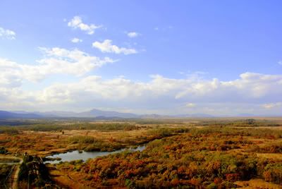
The DMZ and North Korea, as seen from atop the Cheorwon Peace Observatory.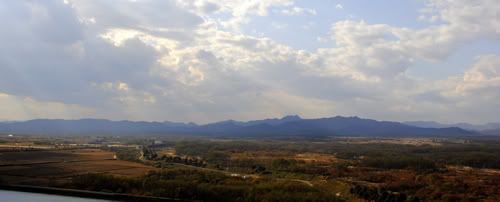
The DMZ and North Korea, as seen from atop the Cheorwon Peace Observatory.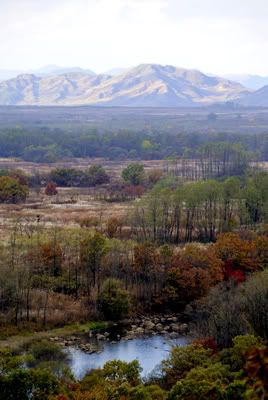
The DMZ and North Korea, as seen from atop the Cheorwon Peace Observatory.After leaving the Cheorwon Observatory, our final stop of the day was the memorial to the Battle of White Horse Ridge. The ridge was strategically important for maintaining the Southern position; had it been lost, the border would no doubt be located further to the south. The ridge changed hands between Northern forces (mostly Chinese troops) and Southern forces (mostly Korean troops) 24 times in ten days. Due to the severe shelling of the ridge, following the battle it was completely devoid of vegetation, and apparently looked like a white horse. Thus the name.
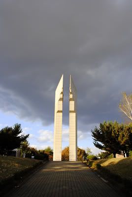
Monument to the Battle of White Horse Ridge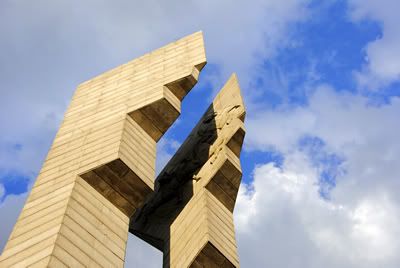
Monument to the Battle of White Horse RidgeAt this point we re-boarded our bus to return to Seoul.
To view the complete set of nearly 200 photos from my trip along the border,
CLICK HERE.
![international [cat] lady of mystery](https://blogger.googleusercontent.com/img/b/R29vZ2xl/AVvXsEgnPJiUgfmMHEUcIPKDuSiTQFpnXgSofemne4WBX0VfEv-Bym8HdPHiD-iC2mNCJQog2tvPXKao_9vpRJG_vl4Yfi0ZTX_p3YpHLCie0rUHAJLgwcAb-Otj7hzc-_UkSI-yRNlpG45z8Wo/s1600/newblogtop2014b.jpg)
